Getty Image
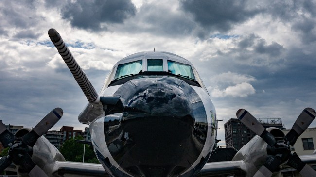
National Oceanic and Atmospheric Administration (NOAA) Hurricane Hunters have one of the the wildest jobs in the world. One of their duties includes flying through storms like Hurricane Milton and taking video.
Lieutenant Commander Josh Rannenberg, who flew in a nine hour mission through Hurricane Milton this week, spoke to ABC News about what that was like.
“When we got to the eye of the storm, it was still a Category 5 hurricane, and I watched it grow from tropical storm to a Cat-5 monster within two missions, which is the fastest I’ve ever seen anything rapidly intensify,” Rannenberg told ABC News.
NOAA’s hurricane hunters fly directly into storms to collect vital data needed to improve forecasts and save lives. @DavidMuir interviews Lieutenant Commander Josh Rannenberg, who flew in a nine hour mission through Hurricane Milton. https://t.co/lSBh0tEiyh pic.twitter.com/p7zyUs90XR
— World News Tonight (@ABCWorldNews) October 10, 2024
“When we were inside the eye, the eye of the storm was very hot, the air was much smoother, and the clouds kind of looked like a stadium building around us, and we were at 8,000 feet, looking all the way down to the ocean, and above us were cloud tops exceeding 55,000 feet,” Rannenberg revealed. “So just towering clouds spinning around us inside the eye of the storm.”
This imagery from @NOAA‘s #GOESEast 🛰️ is providing visible cloud imagery every 30 seconds of #HurricaneMilton as it pushes closer to Florida. Notice the frequent #lightning being picked up by the satellite’s #GLM instrument as well.
Get the latest on #Milton:… https://t.co/33Yng1EYNC pic.twitter.com/5Xjb2K2Y49
— NOAA Satellites (@NOAASatellites) October 9, 2024
“This is the craziest storm that I’ve ever flown inside of, hands down, multiple missions in a row, with the worst turbulence I’ve ever seen, the most lightning, the deepest convection, and just the breadth of the storm, the reach it has is incredible, as well as the power behind it,” Rannenberg explained.
NOAA Hurricane Hunter Nick Underwood shared another video from inside one of the storm chaser’s aircrafts as it passed through Hurricane Milton.
“Pardon my Appalachian hoots and hollers, but this is right up there with the Ian flight from two years ago,” Underwood wrote on X (Twitter). “Floor panels came up. Dropsondes broke. A mess in the cabin. All that turbulence and we still get the dropsonde out to collect data. This is the job. Important work.”
Bumpy ride into Hurricane #Milton on @NOAA WP-3D Orion #NOAA43 “Miss Piggy” to collect data to help improve the forecast and support hurricane research.
Visit https://t.co/3phpgKNx0q for the latest forecasts and advisories
Visit https://t.co/UoRa967zK0 for information that you… pic.twitter.com/ezmXu2Zqta— NOAA Aircraft Operations Center (@NOAA_HurrHunter) October 8, 2024
The NOAA also uses Saildrones to fly into storms like Hurricane Milton to gather video and capture data on the storm.
Footage shared on Thursday revealed a “reported wave height of 28.12 feet and wind gusts as strong as 75.95 mph while 40 nautical miles from the center of the storm.”
Inside Hurricane Milton, @saildrone reported wave height of 28.12 feet and wind gusts as strong as 75.95 mph while 40 nautical miles from the center of the storm. This research represents a collaborative endeavor to better understand the role of the ocean in hurricanes. pic.twitter.com/gmaUopPEWj
— NOAA Atlantic Oceanographic and Meteorological Lab (@NOAA_AOML) October 9, 2024

